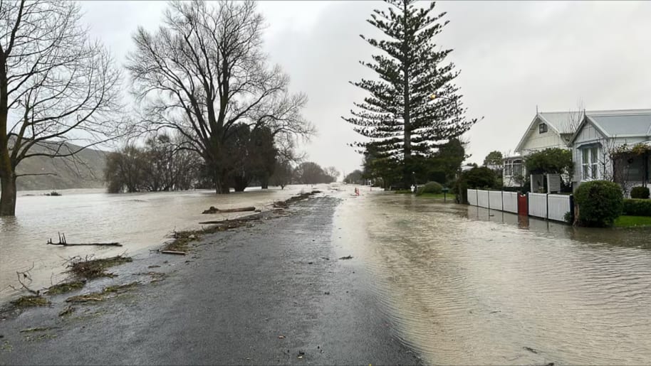
A slow-moving storm has smashed the Tairāwhiti and Hawke’s Bay regions overnight, bringing two months’ worth of rain in some areas that has caused flooding, rough seas and gale-force winds, with more to come today.
The Waipaoa and Wairoa rivers have surged past danger levels, several roads are closed due to slips and power has been shut off in Wairoa township due to rising water levels.
A local State of Emergency has been declared in Wairoa and in Heretaunga in Hawke’s Bay.
Flood warnings and urgent evacuation notices have been issued through the night as rivers rose, with police and fire services going door to door in parts of Tairāwhiti urging people to leave.
The wind and rain has been hammering the area from East Coast to the Wharerata hills south of Gisborne, with around 200mm of rain in some areas in the past 24 hours.
In Te Karaka, where the Waipaoa River has been rising, levels have topped 8m. The township - which was devastated by Cyclone Gabrielle - is now inaccessible. Just before 6am, Te Karaka residents received a Civil Defence emergency alert warning them to evacuate immediately.
The New Zealand Transport Agency said SH35 remains closed between Okitu and Tolaga Bay townships and between Te Araroa and Tikitiki townships.
The agency also reported SH35 Okitu to Tolaga Bay and SH35 Tikitiki to Te Araroa have extensive flooding but are not closed.
This morning Metservice said between 40mm to 70mm of rain was expected still around the inland ranges and coastal hills, and less than 40mm elsewhere.
In Gisborne, 20mm to 40 mm of rain was expected. MetService said there was a minimal chance there would be an upgrade to a red-level warning.
Wairoa District Council announced it was shutting off power to the Wairoa township due to rising water levels putting substations at risk.
"Please stay safe out there," they told residents.
The Wairoa River has risen higher than expected, hitting the orange five-year flooding level at the town bridge around 5am and now at red level, according to Fire and Emergency NZ (Fenz). The district council has told locals to self-evacuate to the War Memorial Hall.
Fenz central shift manager Murray Dunbar says the fire service has been called to help in Wairoa, where the district council wants assistance evacuating people near the mouth of the river.
At 6.10am, Wairoa locals received an emergency mobile alert warnings those in streets near the river: “LEAVE NOW. There is serious flooding in Wairoa. River levels rising rapidly.”
Those evacuating are warned not to walk through floodwaters, which may have washed away parts of the road and could be contaminated.
Some households in Gisborne city were also being urged to evacuate as the Waimatā River rose. The Hikuwai River in Tolaga Bay is also high, with one Tolaga Bay rain gauge receiving more than 285mm of rain since Sunday.
At least seven roads north of Gisborne, including State Highway 35, have been closed due to flooding, slips and collapsed banks, while many other roads are damaged.
Gale-force winds peaked last night with gusts over 100km/h and an average wind speed of almost 70km/h. This morning gusts were still reaching 76km/h.
Dunbar said there had been around 12 weather jobs overnight around the Gisborne area, including a couple of flying trampolines, a roof that was blown off, a window blown in and a tree that fell on a house.
- This article initially reported that a local state of emergency had been declared for Te Karaka. That was incorrect.


0 comment
JOIN THE CONVERSATION
Read and post comments with a
Newsroom Pro subscription.
Subscribe now to start a free
28-day trial.